Services and Equipment available in Geonics Laboratory
Geological Analysis
The Geonics Laboratory offers geological services, which include lithological, structural, and alteration mapping related to environmental studies, exploration of mineral deposits, and geohazard assessments. The studies are carried out using conventional field mapping, remote sensing, x-ray diffraction, and other pertinent analyses.
3D Projection Mapping
Developed by the Geonics Laboratory, 3D projection mapping creates detailed 3D models for projecting various geospatial data, such as lithology, geological structures, rivers, land use, and hazard zones. This technology enhances scientific communication by offering an immersive and interactive way to visualize complex data, making it more accessible and engaging. It’s a powerful tool for research, urban planning, environmental monitoring, and disaster management.

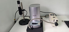
Atomic Force Microscopy
Atomic Force Microscopy (AFM) is a high-resolution imaging technique that measures the surface topography of materials at the nanoscale. It is widely used in materials science, biology, nanotechnology, and semiconductor industries due to its ability to provide both topographical and mechanical data at very small scales.

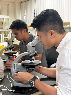
Rock and Clay Sample
Preparation
Sample preparation plays a crucial role in every analysis. It will determine the accuracy and precision of your data. Geonics laboratory offers Rock and Clay sample preparation for different analyses such as petrography, XRD/XRF, AFM, FTIR, SEM and TEM.
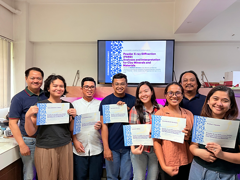
XRD Analysis Training
Geonics Laboratory offers comprehensive training on X-ray Diffraction (XRD) analysis and interpretation, focusing on clay minerals and materials. The training covers a range of sample types, including powder, rock-chip, and oriented samples, providing hands-on experience in conducting XRD analyses. Participants will learn how to effectively interpret diffraction patterns and apply this technique to various geological and material science applications.